Ensuring datasets are readily available to effectively prepare, response and manage an emergency event
In the event of an emergency, the ability to source, integrate and disseminate spatial information is crucial for the emergency management sector. Ensuring datasets are readily available to effectively prepare, response and manage an emergency event, directly supports lifesaving activities, assists impacted communities, and protect critical infrastructure. The duplication of effort to source data during emergency events has led to significant delays and extensive resource implications for emergency organisations.
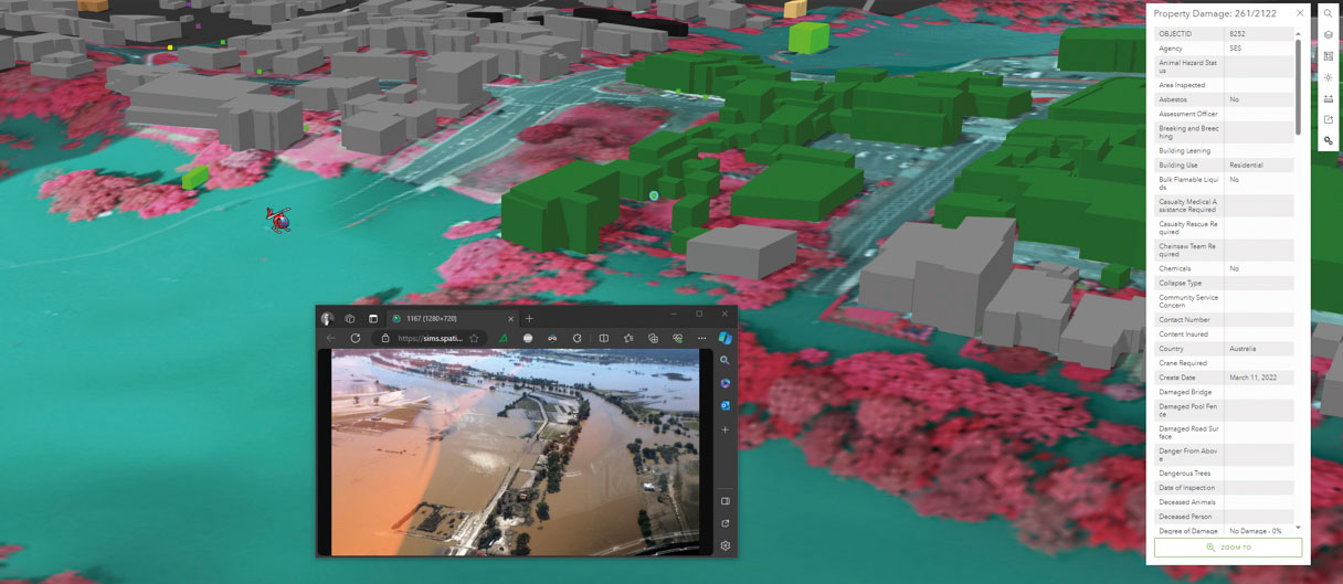
The Emergency Information Coordination Unit (EICU) ensures the emergency management sector has the best spatial and related data available to deal with multi-agency emergencies, such as terrorism and natural disasters. EICU manages the Emergency Management Portal (also referred to as SIMS Portal). This spatial data portal is used for the delivery of emergency management and related spatial content to nominated response and recovery agencies. Access to this portal is restricted to authorised users associated with emergency management, counter terrorism, and critical infrastructure protection. This spatial data portal is used for the delivery of emergency management and related spatial content to nominated response and recovery agencies. Access to this portal is restricted to authorised users associated with emergency management, counter terrorism, and critical infrastructure protection.
Achievements
The EICU:
- supports the safety of the public through the availability of spatial data for management, planning and mitigation of emergencies
- provides accurate and timely data on disasters directly impacting future funding of an emergency and supporting the efficient release of grants to impacted individuals, businesses and the wider community
- coordinates, analyses, and presents recovery data, including post-catastrophe imagery, impact analysis, clean-up efforts, and hazards including waste and asbestos
- provides reliable data for informed decision making
- removes duplication of effort across NSW Government by centralising and streamlining critical data sourcing and standardisation.
Engagement
This project has involved partnership and engagement with the following stakeholders:
- Local, state and federal agencies that have a role in supporting emergency management, including NSW Police Force, Fire & Rescue NSW, NSW Rural Fire Service, State Emergency Service, Surf Life Saving Australia, and NSW Reconstruction Authority.
- Functional agencies including Health, Energy & Utilities, Transport and Telecommunications.
- State, regional and local operation centres, including, the State Crisis Centre, State Emergency Operation Centre, Regional and Local Emergency Operations Centres and the Government Coordination Centre.
Department leading the project
Department of Customer Service – Digital NSW – DCS Spatial Services
Related case studies
For more information, please visit: